March 11, 2012

NE Juneberry St

NE Juneberry St17th Ct NEConnection

My niece helped me pick this week’s street. Our criteria was that it must have an amusing name. NE Juneberry St won out. Turns out it is one of the Issaquah Highlands’ many many “private” streets. I’m not sure what necessitates all this privacy. There’s nothing on the street but houses, so there’s not really any reason for anyone to go there who doesn’t live there or know someone who does. In fact, that’s true for most of the Highlands. Map.

Length: 418 feet.

Subarea: Issaquah Highlands.

Intersects with: 17th Ave NE and 16th Ln NE

Car lanes: 1.5 maybe?

Speed limit: 25mph (none posted)

Grade: Moderate slope down to the west.

Signage: None.

Sidewalks: 50% Along all of north side.

Bike lanes: No.

Bus stops: No. Nearest 2/3 mile away at Highlands Park and Ride.

Walkscore: 34

Attractions: Near Grand Ridge Elementary.

Bike/ped-only connections: This is one thing the Highlands developer got right at least for pedestrians. There are staircases between all the culdesacs and the nearest streets. Three of them on this short stretch of street alone. Not much help if you’re pushing a stroller, though.

Green: Sparse landscaping.

Zoning: Urban Village

Potential improvements: The built environment of this street is basically appropriate for its location. It’s essentially a driveway with slow traffic, so bikes should be able to share the road. The street is close enough to NE Park Dr that it would benefit if bus service is ever extended up into the Highlands proper.

March 8, 2012

NW Dogwood St

NW Dogwood StNW Dogwood StNW Dogwood StNW Dogwood St

NW Dogwood St is one of only two through streets between Front St N and Newport Way. As such, it sees heavy vehicle usage with relatively high speeds as drivers use it to circumvent traffic delays on other local streets. It has a mix of residential densities from single-family dwellings to large apartment complexes. Map.

Length: 1942 feet.

Subarea: Spans Gilman and Old Town.

Intersects with: Front St N, Rainier Blvd N., 1st Pl NW, 1st Ave NW, 3rd Pl NW, 3rd Ct NW, Newport Way NW

Car lanes: 2

Speed limit: 25mph

Grade: Flat.

Signage: Pedestrian-triggered signal at Front St (stop sign for cars), Stop sign at Newport Way. Otherwise it’s a clear quarter-mile shot from Front St to Newport.

Sidewalks: 38% Both sides from Front St to 1st Ave, then a few semi-random stretches west of there.

Bike lanes: No.

Bus stops: No. Nearest: Front St: 200, 209, 214 (commute), 271 (after hours)

Walkscore: Max: 78 Min: 71

Attractions: Nothing really.

Bike/ped-only connections: There’s a pedestrian-only trail at the end of 3rd Pl NW which connects through to Holly St. Though it’s mostly blocked by a fallen tree at the moment. Pedestrian crossing signal at Front St that takes forever to change.

Green: About midway down there’s a bridge across Issaquah Creek with attendant greenery. Otherwise, street trees and landscaping.

Zoning: Multifamily Medium with “Cultural and Business District” east of 1st Ave and “Single family small lot” between 3rd Pl and the creek

Potential improvements: This street really deserves a full buildout with sidewalks and bike lanes. As it is, it’s a street with faster-than-speed-limit traffic and nowhere for pedestrians to walk. On the cheaper side, the pedestrian signal at Front Street should really be more responsive.

February 21, 2012

SW Clark St

SW Clark StDead end

Short dead-end street at the base of Squak Mountain. Both sides are lined with apartments and townhouses. Map.

Length: 692 feet.

Subarea: Gilman. No, that doesn’t make any sense to me either.

Intersects with: Wildwood Blvd SW

Car lanes: 2 if you’re friendly

Speed limit: 25 (none posted)

Grade: Moderate.

Signage: Stop sign at Wildwood that joins up with the traffic signal at Wildwood and Newport.

Sidewalks: 50%. Full length of the north side.

Bike lanes: No. Light, slow traffic so little need.

Bus stops: No. Nearest: Newport by Gibson Hall: 214 (commute), 271 (after hours)

Walkscore: 75

Attractions: Gibson Park is adjacent to the aptly-named Issaquah Parkview Condominiums

Bike/ped-only connections: There’s a railroad tie staircase into one of the apartment complexes at the end of the road. There are also a couple of muddy game trails leading off into the woods from the end. One of the trails seems to connect to an apartment complex off Mountain Park Blvd SW. The other dead ends in a feral teenager nest/trash dump after a few dozen yards.

Green: The east end of the street is opposite the Issaquah Creek corridor. The west end abuts a wooded lower slope of Squak Mountain. Street trees and nearby Gibson Park.

Zoning: Multifamily High

Potential improvements: Formalize the trail to Mountain Park Blvd. Clean out the trash heap on the hillside.

February 12, 2012

4th Ave NW

4th Ave NWGateway to the Pickering TrailCrossingChoose your path4th Ave NW

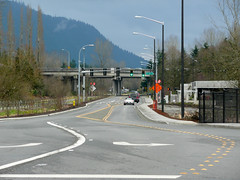
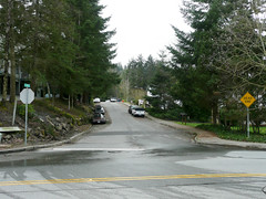
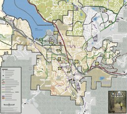
The newest street in Issaquah at the moment. Built in 2011, this street gave a much-needed additional vehicle crossing of the I-90 corridor with the added benefit of being the only one we have which doesn’t also have to deal with freeway-bound traffic. The city plans to extend this street north along what is now 221st Pl SE all the way to SE 56th St. This would also connect to another new road being proposed which would extend SE 62nd St across the wetlands and Issaquah Creek into the south end of the Pickering Place development. Map.

Length: 2020 feet. There’s a second approximately 1000 foot segment along the old Zetec access road which has been restricted to one-way northbound with parking along one side.

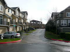
Subarea: Gilman/North Issaquah

Intersects with: NW Gilman Blvd, SE 62nd St, SE 64th Pl, 221st Pl SE

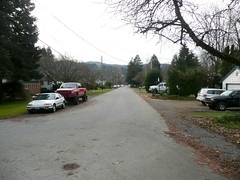
Car lanes: 2 plus turn lanes.

Speed limit: 35

Grade: Flat.

Signage: Four-way signal at Gilman and post office entrance. Pedestrian signal at SE 64th Pl. Three-way signal at SE 62nd St.

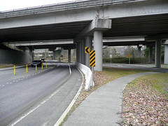
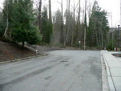
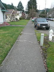
Sidewalks: 64%. Permeable cement except at intersections. Full length on the west edge. From Gilman to just under the freeway on the east edge where it connects to the East Lake Sammamish Trail (ELST) which runs parallel and adjacent to the north portion of the street. At the time of this writing, the ELST is still gravel. Also the west edge sidewalk is closed to pedestrian traffic by signage north of the Pickering Trail since there is currently nowhere for pedestrians to go at the intersection with SE 62nd St.

Bike lanes: No. I suspect that the thinking was that cyclists would use the ELST once it is paved. Currently most cyclists seem to ride on the street despite the lack of any significant shoulder for most of the length of the street. It will be interesting to see if this changes once the ELST is paved.

Bus stops: No. Nearest: Gilman Blvd access to the 200, 209, 214 (commute), 271 (after hours). Black Nugget access to 269, 927.

Walkscore: max: 80 min: 78

Attractions: Post Office.

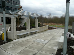
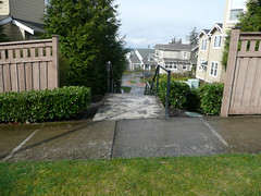
Bike/ped-only connections: East Lake Sammamish Trail parallels the street and intersects with the Pickering Trail with pedestrian access to Pickering Place and the Issaquah Farmers’ Market at the Pickering Barn. ELST also intersects with the Preston Trail below the freeway. The south end of the street gives access to the Gilman Blvd edible landscaping trail. East of the street north of the freeway there is pedestrian access to the parking lot of the Meadow Creek office complex.

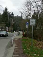
Green: Quite a bit though most is zoned for development. The triangular lot between Gilman, ELST, and 4th Ave is largely wooded behind Gilman Station. North of the freeway, to the east is green space behind the old used car lot on East Lake Sammamish Parkway. To the west is restored wetland adjacent to Issaquah Creek. The north end bridges the North fork of Issaquah Creek.

Zoning: “Retail” south of freeway. “Commercial” for new medical office building on old Zetec property and Meadow Creek. “Community Facilities-Recreation” for the Pickering trail corridor. “Retail” for the portion north of Meadow Creek.

Potential improvements: As a new street it is in good repair. It’s unfortunate that bike lanes were not included in the design. Formalized pedestrian connections to the Meadow Creek complex parking lot would be well-used. Connections to the ELST should be reviewed after it is paved.

February 5, 2012

NE Birch St

NE Birch StreetHalf a sidewalkSidewalkNE Birch Street

A quiet residential street near downtown. The neighborhood is in transition from single-family homes on large lots to lot-filling duplexes. So density will approximately double over the next several decades. Map.

Length: 1077 feet

Subarea: Old Town

Intersects with: 5th Ave NE, 3rd Ave NE, 2nd Ave NE

Car lanes: 2. no lines.

Speed limit: 25

Grade: Flat. Slopes down slightly east to west.

Signage: Two-way stops at 2nd and 3rd.

Sidewalks: 58%. 4-foot. Owner-maintained. Varying condition from new on down. Most foot traffic takes the lane.

Bike lanes: No. With light, slow traffic, no real need.

Bus stops: No. Nearest: Sunset Way access to 209, 554, 927

Walkscore: max: 74 min: 63

Amenities: Memorial Field at west end. One block to 3rd Ave NE pedestrian bridge.

Bike/ped-only connections: no

Green: private lawns and landscaping, view to N fork Issaquah Creek at 5th Ave

Land use: Single Family Duplex

Potential improvements: Good candidate for lowered speed limit when that becomes legal. Sidewalks could use improvement, but it’s relatively low priority since it’s mostly safe to walk in the street. Crosswalk between Memorial Field and the north side of the street is in ill repair.

May 18, 2011

Still alive

Despite the moribund appearance of our website, GAIT is still alive.

I hope to get back to posting here regularly and having some more visible activities available to folks soon (for some definition of “soon” ;-). In the mean time I thought I should get something up here for any new people who wander by.

Our Facebook page maintained by the lovely and talented Becky Brooks is the  most active evidence of our continued existence. Take a look and Like us to get occasional links of interest about walk/bike/bus tranportation. http://www.facebook.com/GettingAroundIssaquah

Otherwise, our mailing list (link in the sidebar) is the best way to keep up on GAIT activities. I’ll be sure to announce when the blog becomes more active as well.

Thanks for stopping by, and let us know if there’s anything we can do to make it easier for you to get around Issaquah.

October 2, 2009

Bike/ped counts

I haven’t heard from many people about this week’s bike/ped counts, but here are the numbers I have. I’ll update this post if I get more.

Where, When, Weather Mode Northbound Southbound Eastbound Westbound Total
Newport Way SW and Front St S,
9/29 7am-9am,
50F partly cloudy
Bike 3 0 2 2 7
Ped 14 0 60 14 88
E Sunset Way and 6th Ave NE,
10/1 7am-9am,
52F partly cloudy
Bike 0 0 1 1 2
Ped 2 2 6 3 13
Newport Way SW and Front St S,
10/1 4pm-6pm,
50F partly cloudy
Ped 9 11 7 9 36
Other 2 0 2 0 4
Newport Way and SR-900,
10/1 4pm-6pm,
58F raining
Bike 1 1 6 3 11
Ped 0 0 3 4 7
Where, When, Weather Mode Northbound Southbound Eastbound Westbound Total

September 14, 2009

PARK(ing) Day

This Friday, September 19 is PARK(ing) Day. This is the day when communities around the world take back a bit of their town that has been set aside for cars and turn it into a park.

That’s right, GAIT has partnered with our friends at artEAST to turn a parking space across Front Street from UP Front Gallery into a park for one day. The plan is to have (simulated) grass, (real) plants, (real) artists making (real) art, and a (real) bike rack.

There is more info about the event at the Issaquah PARK(ing) Day group page.

If you plan to stop by and enjoy the park, you can RSVP for the event.

If you can hang out at the park for an hour or two on Friday, keep an eye on things, and explain the concept to curious passers-by, fire me an email with your availability and I’ll coordinate. The park will be open from 5am to 9pm.

Tell your friends, and I hope to see you at the park!

August 7, 2009

Bicycle Alliance’s Traffic Signal Bill Gets Implemented

During the last legislative session in Olympia, the Bicycle Alliance of Washington worked hard to get legislation to address the issue of vehicle detection systems not turning lights green for bicycles and motorcycles. They succeeded with Senate Bill 5482 (Section 10).

Now it is time to let jurisdictions know when those two wheels are not enough to turn the light green. While the detectors may not get fixed right away, they can prioritize locations based on the information you provide. Here is how to do it:

For Issaquah city streets, contact the Public Works Operations department using the information or form on the city’s contact form.

For the city of Sammamish, it looks like the best way is to submit a Citizen Action Request. (You can do that for Issaquah too, but they don’t have an online method of submission. They have a form you can print out and mail.)

For signals in unincorporated King County, contact the county using this form.

For state highways, contact the Washington State Department of Transportation, identifying the specific location.

What the bill says basically is that signal detectors must detect bikes and that if the detector isn’t marked then the detection zone should be assumed to be in the center of the travel lane just behind the stop line. If there is a signal on your route which doesn’t detect bikes and you don’t feel safe crossing against the signal, please use the methods above to notify the city or state of the failing intersection.

August 6, 2009

Bicycle Issaquah!

thumbnail of Issaquah Bike MapKaren Behm has been working on a bike map for Issaquah for over a year now, and Tuesday afternoon the first edition came back from the printer! You can pick up your copy at the Visitor Center, Bicycle Center, or Veloce Velo. Or flag me down around town, I’ve got a stack in the trunk on my bike.

If you’d like to peer at it on your computer, you can download it right here as two big PDF files. One of 2MB for the map itself and another of a whopping 6.6MB for the back side with the notes, some ride directions, and other useful info.

But get a paper copy, it’s fabulous! And give Karen an attagirl next time you see her.

Big thanks to the City for funding this first printing out of the hotel room tax revenue. And big thanks to Councilman Fred Butler for cluing us in to that funding option.

UPDATE: The printed maps are all gone for the moment. Email us if you want one and we’ll put you on the list for when we get another print run funded or if we find some hiding in a corner somewhere.